Durban International Airport
Daylight today(Oct 19, 2026, local time)
About 12h 54m of daylight. Civil twilight (dawn/dusk) approximates the FAA definition of night for logging and currency. Times are computed and approximate — verify with official sources.
About Durban International Airport
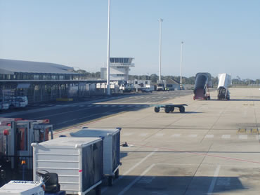
Durban International Airport (formerly Louis Botha Airport) was the international airport of Durban from 1951 until 2010, when it was replaced by King Shaka International Airport, 60 kilometres (37 mi) to the north. The airport is co-located with AFB Durban.
Summary from Wikipedia, photo via Wikimedia Commons, licensed under CC BY-SA.
Live traffic nearby
Aircraft currently within ~40 nm, from live ADS-B. Positions are approximately real-time — not for navigation.
Live ADS-B by adsb.lol & the OpenSky Network. Not for navigation.
Map
Runway centrelines, navaids and overlapping airspace. Tiles © OpenStreetMap contributors. Reference only — not for navigation.
Runways (1)
| Runway | Length | Width | Surface | Lighting | Status |
|---|---|---|---|---|---|
| 06 / 24 | 8,005 ft / 2,440 m | 200 ft | Asp | Lighted | Open |
Radio frequencies (4)
| Type | Description | Frequency |
|---|---|---|
| APP | APP | 119.100 MHz |
| ATIS | ATIS | 127.000 MHz |
| GTE | APRON | 122.650 MHz |
| TWR | TWR | 118.700 MHz |
Navaids(1)
Airspace in this area(7)
| Name | Class | Type | Floor | Ceiling |
|---|---|---|---|---|
| AWY A402 | Class A | Airway | FL145 | FL245 |
| CTA DURBAN A | Class C | Controlled | FL145 | FL200 |
| CTA DURBAN B | Class C | Controlled | FL105 | FL145 |
| TMA FALE F | Class C | Controlled | 2000 ft MSL | FL145 |
| TMA FALE C | Class C | Controlled | 5500 ft MSL | FL145 |
| TMA FALE D | Class C | Controlled | 3500 ft MSL | FL145 |
| FA-R50 DURBAN | Special use | Restricted | GND | 500 ft MSL |
Approximate bounding-box match from OpenAIP · all South Africa airspace. Reference only — consult official charts for exact boundaries and status.
Tall obstacles nearby
| Obstacle | Height AGL | Top (MSL) | Lit |
|---|---|---|---|
| Obstacle | 325 ft | 217 ft | — |
| Obstacle | 295 ft | 203 ft | — |
| Obstacle | 295 ft | 190 ft | — |
| Obstacle | 295 ft | 226 ft | — |
| 320 West Street | 295 ft | 161 ft | — |
| Obstacle | 295 ft | 174 ft | — |
| Commercial City | 295 ft | 82 ft | — |
| Obstacle | 282 ft | 62 ft | — |
Tallest obstacles within ~10 nm. Data via OpenAIP. Reference only — consult official charts.
Frequently asked questions
Where is Durban International Airport located?
Durban International Airport is closed located in Durban, South Africa, at an elevation of 33 ft (10 m).
How many runways does Durban International Airport have?
Durban International Airport has 1 runway, the longest being 8,005 ft / 2,440 m.
Is the information on this page suitable for flight planning?
No. Durban International Airport data here is for reference and training only — not for navigation. Always consult official sources and current charts before any flight.