RNAS Cattewater/RAF Cattewater/RAF Mount Batten
Daylight today(Oct 15, 2026, local time)
About 10h 48m of daylight. Civil twilight (dawn/dusk) approximates the FAA definition of night for logging and currency. Times are computed and approximate — verify with official sources.
About RNAS Cattewater/RAF Cattewater/RAF Mount Batten
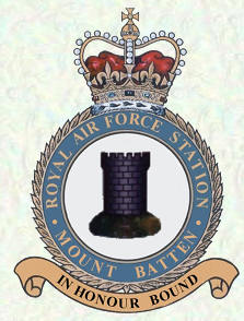
Royal Air Force Mount Batten, or more simply RAF Mount Batten, is a former Royal Air Force station and flying boat base at Mount Batten, a peninsula in Plymouth Sound, Devon, England, UK. Originally a seaplane station opened in 1917 as a Royal Navy Air Service Station Cattewater it became RAF Cattewater in 1918 and in 1928 was renamed RAF Mount Batten. The base is named after Captain Batten, a Civil War commander who defended this area at the time, with the Mountbatten family motto In Honour Bound taken as the station's motto.
Summary from Wikipedia, photo via Wikimedia Commons, licensed under CC BY-SA.
Live traffic nearby
Aircraft currently within ~40 nm, from live ADS-B. Positions are approximately real-time — not for navigation.
Live ADS-B by adsb.lol & the OpenSky Network. Not for navigation.
Map
Runway centrelines, navaids and overlapping airspace. Tiles © OpenStreetMap contributors. Reference only — not for navigation.
Runways (1)
| Runway | Length | Width | Surface | Lighting | Status |
|---|---|---|---|---|---|
| lower / higher▸ displaced | — | — | — | Lighted | Open |
Radio frequencies (1)
| Type | Description | Frequency |
|---|---|---|
| brandonlubin | brandonlubin | 118.500 MHz |
Airspace in this area(1)
| Name | Class | Type | Floor | Ceiling |
|---|---|---|---|---|
| D009B WEMBURY | Special use | Danger | GND | 22000 ft MSL |
Approximate bounding-box match from OpenAIP · all United Kingdom airspace. Reference only — consult official charts for exact boundaries and status.
VFR reporting points nearby
| Point | Distance | Bearing | Reporting |
|---|---|---|---|
| AVONE | 10.5 nm | 116° | On request |
Named VFR reporting points within ~20 nm; distance and bearing are from the airport reference point. Data via OpenAIP. Reference only — check the current VAC/AIP for procedures and whether a report is required.
Tall obstacles nearby
| Obstacle | Height AGL | Top (MSL) | Lit |
|---|---|---|---|
| Obstacle | — | 397 ft | — |
| Obstacle | — | 240 ft | — |
| Obstacle | — | 331 ft | — |
| Obstacle | — | 354 ft | — |
| Obstacle | — | 381 ft | — |
| Obstacle | — | 636 ft | — |
| Obstacle | — | 525 ft | — |
Tallest obstacles within ~10 nm. Data via OpenAIP. Reference only — consult official charts.
Frequently asked questions
Where is RNAS Cattewater/RAF Cattewater/RAF Mount Batten located?
RNAS Cattewater/RAF Cattewater/RAF Mount Batten is closed located in Devon, United Kingdom.
How many runways does RNAS Cattewater/RAF Cattewater/RAF Mount Batten have?
RNAS Cattewater/RAF Cattewater/RAF Mount Batten has 1 runway.
Is the information on this page suitable for flight planning?
No. RNAS Cattewater/RAF Cattewater/RAF Mount Batten data here is for reference and training only — not for navigation. Always consult official sources and current charts before any flight.